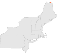
173219 - GRAND ISLE, Maine

Latitude
47° 18´N
Longitude
68° 9´W
Elevation
146 meters

COOP Northeast

Maine
Help

Main
10 nearest COOP Northeast stations
14 miSE :VAN BUREN 2, ME
21 miW :FORT KENT 2, ME
22 miWSW :FORT KENT, ME
28 miSW :EAGLE LAKE, ME
30 miS :CARIBOU MUNICIPAL ARPT, ME
36 miWSW :ST FRANCIS, ME
39 miSSE :FORT FAIRFIELD 5 NE, ME
43 miS :PRESQUE ISLE MUNICIP, ME
43 miWSW :ALLAGASH, ME
45 miS :PRESQUE ISLE, ME

Weather variables    Help
Click a weather variable name to jump down to those statistics.
Total
observations
%
NDJFM
observations
%
TMAX
762
4.2%
334
4.4%
TMIN
762
4.2%
334
4.4%
PRCP
762
4.2%
334
4.4%
SNOW
761
4.2%
333
4.4%


TMAX     top of page

Data not shown:
Less than 5% of days have TMAX observations during NDJFM over 1948-1997


TMIN     top of page

Data not shown:
Less than 5% of days have TMIN observations during NDJFM over 1948-1997


PRCP (total liquid water equivalent)     top of page

Data not shown:
Less than 5% of days have PRCP observations during NDJFM over 1948-1997


SNOW     top of page

Data not shown:
Less than 5% of days have SNOW observations during NDJFM over 1948-1997