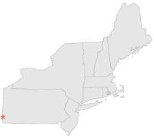
361512 - CLAYSVILLE 3 W, Pennsylvania

Latitude
40° 7´N
Longitude
80° 28´W
Elevation
305 meters

COOP Northeast

Pennsylvania
Help

Main
10 nearest COOP Northeast stations
2 miESE :CLAYSVILLE 2 SW, PA
8 miE :WASHINGTON 6 SW, PA
13 miENE :WASHINGTON, PA
16 miENE :WASHINGTON 3 NE, PA
18 miN :BURGETTSTOWN 2 W, PA
20 miSE :WAYNESBURG 2 W, PA
22 miSE :WAYNESBURG 1 E, PA
27 miESE :RICES LANDING L 6, PA
27 miESE :RICES LANDING L 6 UPPER, PA
28 miENE :BRUCETON 1 S, PA

Weather variables    Help
Click a weather variable name to jump down to those statistics.
Total
observations
%
NDJFM
observations
%
TMAX
8358
45.8%
3536
46.8%
TMIN
8406
46.0%
3559
47.1%
PRCP
8423
46.1%
3569
47.2%
SNOW
7636
41.8%
2992
39.6%


TMAX     Help     top of page

TMAX
observations
mean
std dev
   
Distribution
during extreme days of
NDJFM
3536  by year
45.1°F
13.2°F
   
overall
NAM
PNA
CTI

TMAX and NAM    Help
scatterplot
days
by month
mean
NAM index
extreme high
NAM days
extreme low
NAM days
ratio of extreme
high:low NAM days
Extreme high events
Days with TMAX>=66°F
248
-0.08
25
35
1.4
map
table
Extreme low events
Days with TMAX<=26°F
250
-0.66
27
81
3.0*
map
table

TMAX and PNA    Help
scatterplot
days
by month
mean
PNA index
extreme high
PNA days
extreme low
PNA days
ratio of extreme
high:low PNA days
Extreme high events
Days with TMAX>=66°F
248
-0.64
8
60
7.5*
map
table
Extreme low events
Days with TMAX<=26°F
250
0.64
79
21
3.8*
map
table

TMAX and CTI    Help
days
by month
high CTI days
(moderate to strong
El Niño winters)
low CTI days
(moderate to strong
La Niña winters)
ratio of high:low CTI
(El Niño:La Niña days)
Extreme high events
Days with TMAX>=66°F
248
25
48
1.9*
map
table
Extreme low events
Days with TMAX<=26°F
250
43
46
1.1
map
table

TMAX under 2 index extremes     Help
Station table Maps - choose one extreme:
High NAMLow NAM High PNALow PNA High CTILow CTI


TMIN     Help     top of page

TMIN
observations
mean
std dev
   
Distribution
during extreme days of
NDJFM
3559  by year
22.8°F
12.8°F
   
overall
NAM
PNA
CTI

TMIN and NAM    Help
scatterplot
days
by month
mean
NAM index
extreme high
NAM days
extreme low
NAM days
ratio of extreme
high:low NAM days
Extreme low events
Days with TMIN<=2°F
238
-0.54
21
64
3.0*
map
table
Extreme high events
Days with TMIN>=41°F
250
-0.07
31
35
1.1
map
table

TMIN and PNA    Help
scatterplot
days
by month
mean
PNA index
extreme high
PNA days
extreme low
PNA days
ratio of extreme
high:low PNA days
Extreme low events
Days with TMIN<=2°F
238
0.47
76
31
2.5*
map
table
Extreme high events
Days with TMIN>=41°F
250
-0.55
13
64
4.9*
map
table

TMIN and CTI    Help
days
by month
high CTI days
(moderate to strong
El Niño winters)
low CTI days
(moderate to strong
La Niña winters)
ratio of high:low CTI
(El Niño:La Niña days)
Extreme low events
Days with TMIN<=2°F
238
28
36
1.3
map
table
Extreme high events
Days with TMIN>=41°F
250
27
53
2.0*
map
table

TMIN under 2 index extremes     Help
Station table Maps - choose one extreme:
High NAMLow NAM High PNALow PNA High CTILow CTI


PRCP (total liquid water equivalent)     Help     top of page

PRCP
observations
mean
   
Distribution
during extreme days of
NDJFM
3569  by year
0.09"
   
overall
NAM
PNA
CTI

PRCP and NAM    Help
scatterplot
days
by month
mean
mean
NAM index
extreme high
NAM days
extreme low
NAM days
ratio of extreme
high:low NAM days
Observed events
Days with PRCP>0.00"
1478
0.23"
-0.29
161
322
2.0*
map
table
Extreme events
Days with PRCP>0.38"
279
0.68"
-0.26
29
57
2.0*
map
table

PRCP and PNA    Help
scatterplot
days
by month
mean
mean
PNA index
extreme high
PNA days
extreme low
PNA days
ratio of extreme
high:low PNA days
Observed events
Days with PRCP>0.00"
1478
0.23"
-0.03
242
268
1.1
map
table
Extreme events
Days with PRCP>0.38"
279
0.68"
-0.25
44
66
1.5
map
table

PRCP and CTI    Help
days
by month
mean
high CTI days
(moderate to strong
El Niño winters)
low CTI days
(moderate to strong
La Niña winters)
ratio of high:low CTI
(El Niño:La Niña days)
Observed events
Days with PRCP>0.00"
1478
0.23"
163
347
2.1*
map
table
Extreme events
Days with PRCP>0.38"
279
0.68"
27
73
2.7*
map
table

PRCP under 2 index extremes     Help
Station table Maps - choose one extreme:
High NAMLow NAM High PNALow PNA High CTILow CTI


SNOW     Help     top of page

SNOW
observations
mean
   
Distribution
during extreme days of
NDJFM
2992  by year
0.19"
   
overall
NAM
PNA
CTI

SNOW and NAM    Help
scatterplot
days
by month
mean
mean
NAM index
extreme high
NAM days
extreme low
NAM days
ratio of extreme
high:low NAM days
Observed events
Days with SNOW>0.0"
283
1.96"
-0.43
27
72
2.7*
map
table
Extreme events
Days with SNOW>3.0"
34
6.30"
-0.36
3
7
2.3
map
table

SNOW and PNA    Help
scatterplot
days
by month
mean
mean
PNA index
extreme high
PNA days
extreme low
PNA days
ratio of extreme
high:low PNA days
Observed events
Days with SNOW>0.0"
283
1.96"
0.57
77
23
3.3*
map
table
Extreme events
Days with SNOW>3.0"
34
6.30"
0.46
13
4
3.2
map
table

SNOW and CTI    Help
days
by month
mean
high CTI days
(moderate to strong
El Niño winters)
low CTI days
(moderate to strong
La Niña winters)
ratio of high:low CTI
(El Niño:La Niña days)
Observed events
Days with SNOW>0.0"
283
1.96"
20
49
2.4*
map
table
Extreme events
Days with SNOW>3.0"
34
6.30"
2
2
1.0
map
table

SNOW under 2 index extremes     Help
Station table Maps - choose one extreme:
High NAMLow NAM High PNALow PNA High CTILow CTI