| Latitude 44° 34´N |
Longitude 112° 48´W |
Elevation 2015 meters |
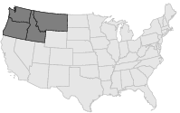
 COOP Northwest |
 Montana |
Help Main |
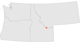
| 4 mi | SW : | DELL 19 SW, MT |
| 7 mi | ENE : | LIMA, MT |
| 7 mi | NNE : | DELL, MT |
| 13 mi | ENE : | LIMA DAM, MT |
| 14 mi | E : | MONIDA, MT |
| 16 mi | SSW : | DUBOIS 34 W, ID |
| 17 mi | N : | ARMSTEAD, MT |
| 17 mi | E : | MONIDA 5 NE, MT |
| 20 mi | ESE : | SPENCER RANGER STN, ID |
| 22 mi | SE : | DUBOIS EXPERIMENT STN, ID |