| Latitude 38° 38´N |
Longitude 90° 16´W |
Elevation 165 meters |
 COOP Northern Plains |
 Missouri |
Help Main |
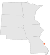
| 2 mi | E : | ST LOUIS ST LOUIS UNIV, MO |
| 3 mi | WNW : | SAINT LOUIS WASHINGTON UNIV, MO |
| 4 mi | E : | ST LOUIS EADS BRIDGE, MO |
| 4 mi | E : | ST LOUIS EADS BRIDGE, MO |
| 7 mi | SW : | WEBSTER GROVES, MO |
| 10 mi | NW : | ST LOUIS LAMBERT INT'L ARPT, MO |
| 13 mi | WSW : | VALLEY PARK, MO |
| 14 mi | WNW : | ST CHARLES 7 SSW, MO |
| 16 mi | NW : | ST CHARLES, MO |
| 20 mi | NW : | ST LOUIS WSO, MO |