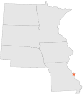
237455 - ST LOUIS LAMBERT INT'L ARPT, Missouri

Latitude
38° 45´N
Longitude
90° 22´W
Elevation
173 meters

COOP Northern Plains

Missouri
Help

Main
10 nearest COOP Northern Plains stations
7 miSSE :SAINT LOUIS WASHINGTON UNIV, MO
8 miWNW :ST CHARLES, MO
9 miWSW :ST CHARLES 7 SSW, MO
10 miSE :ST LOUIS SCIENCE CTR, MO
11 miSE :ST LOUIS ST LOUIS UNIV, MO
11 miWNW :ST LOUIS WSO, MO
12 miSE :ST LOUIS EADS BRIDGE, MO
13 miS :WEBSTER GROVES, MO
13 miSE :ST LOUIS EADS BRIDGE, MO
15 miSSW :VALLEY PARK, MO

Weather variables    Help
Click a weather variable name to jump down to those statistics.
Total
observations
%
NDJFM
observations
%
TMAX
18262
100.0%
7563
100.0%
TMIN
18260
100.0%
7560
100.0%
PRCP
18263
100.0%
7563
100.0%
SNOW
18067
98.9%
7519
99.4%


TMAX     Help     top of page

TMAX
observations
mean
std dev
   
Distribution
during extreme days of
NDJFM
7563  by year
46.5°F
14.8°F
   
overall
NAM
PNA
CTI

TMAX and NAM    Help
scatterplot
days
by month
mean
NAM index
extreme high
NAM days
extreme low
NAM days
ratio of extreme
high:low NAM days
Extreme high events
Days with TMAX>=70°F
510
0.31
101
43
2.3*
map
table
Extreme low events
Days with TMAX<=25°F
547
-0.45
69
151
2.2*
map
table

TMAX and PNA    Help
scatterplot
days
by month
mean
PNA index
extreme high
PNA days
extreme low
PNA days
ratio of extreme
high:low PNA days
Extreme high events
Days with TMAX>=70°F
510
-0.48
30
120
4.0*
map
table
Extreme low events
Days with TMAX<=25°F
547
0.29
134
85
1.6*
map
table

TMAX and CTI    Help
days
by month
high CTI days
(moderate to strong
El Niño winters)
low CTI days
(moderate to strong
La Niña winters)
ratio of high:low CTI
(El Niño:La Niña days)
Extreme high events
Days with TMAX>=70°F
510
75
109
1.5*
map
table
Extreme low events
Days with TMAX<=25°F
547
57
65
1.1
map
table

TMAX under 2 index extremes     Help
Station table Maps - choose one extreme:
High NAMLow NAM High PNALow PNA High CTILow CTI


TMIN     Help     top of page

TMIN
observations
mean
std dev
   
Distribution
during extreme days of
NDJFM
7560  by year
28.7°F
12.4°F
   
overall
NAM
PNA
CTI

TMIN and NAM    Help
scatterplot
days
by month
mean
NAM index
extreme high
NAM days
extreme low
NAM days
ratio of extreme
high:low NAM days
Extreme low events
Days with TMIN<=8°F
514
-0.47
65
140
2.2*
map
table
Extreme high events
Days with TMIN>=47°F
520
0.33
102
41
2.5*
map
table

TMIN and PNA    Help
scatterplot
days
by month
mean
PNA index
extreme high
PNA days
extreme low
PNA days
ratio of extreme
high:low PNA days
Extreme low events
Days with TMIN<=8°F
514
0.35
143
77
1.9*
map
table
Extreme high events
Days with TMIN>=47°F
520
-0.55
20
118
5.9*
map
table

TMIN and CTI    Help
days
by month
high CTI days
(moderate to strong
El Niño winters)
low CTI days
(moderate to strong
La Niña winters)
ratio of high:low CTI
(El Niño:La Niña days)
Extreme low events
Days with TMIN<=8°F
514
44
64
1.5*
map
table
Extreme high events
Days with TMIN>=47°F
520
104
87
1.2
map
table

TMIN under 2 index extremes     Help
Station table Maps - choose one extreme:
High NAMLow NAM High PNALow PNA High CTILow CTI


PRCP (total liquid water equivalent)     Help     top of page

PRCP
observations
mean
   
Distribution
during extreme days of
NDJFM
7563  by year
0.09"
   
overall
NAM
PNA
CTI

PRCP and NAM    Help
scatterplot
days
by month
mean
mean
NAM index
extreme high
NAM days
extreme low
NAM days
ratio of extreme
high:low NAM days
Observed events
Days with PRCP>0.00"
2316
0.29"
-0.01
387
399
1.0
map
table
Extreme events
Days with PRCP>0.46"
455
0.93"
0.05
78
70
1.1
map
table

PRCP and PNA    Help
scatterplot
days
by month
mean
mean
PNA index
extreme high
PNA days
extreme low
PNA days
ratio of extreme
high:low PNA days
Observed events
Days with PRCP>0.00"
2316
0.29"
-0.23
276
465
1.7*
map
table
Extreme events
Days with PRCP>0.46"
455
0.93"
-0.48
28
106
3.8*
map
table

PRCP and CTI    Help
days
by month
mean
high CTI days
(moderate to strong
El Niño winters)
low CTI days
(moderate to strong
La Niña winters)
ratio of high:low CTI
(El Niño:La Niña days)
Observed events
Days with PRCP>0.00"
2316
0.29"
357
353
1.0
map
table
Extreme events
Days with PRCP>0.46"
455
0.93"
82
70
1.2
map
table

PRCP under 2 index extremes     Help
Station table Maps - choose one extreme:
High NAMLow NAM High PNALow PNA High CTILow CTI


SNOW     Help     top of page

SNOW
observations
mean
   
Distribution
during extreme days of
NDJFM
7519  by year
0.13"
   
overall
NAM
PNA
CTI

SNOW and NAM    Help
scatterplot
days
by month
mean
mean
NAM index
extreme high
NAM days
extreme low
NAM days
ratio of extreme
high:low NAM days
Observed events
Days with SNOW>0.0"
690
1.37"
-0.30
97
173
1.8*
map
table
Extreme events
Days with SNOW>2.1"
135
4.41"
-0.33
21
37
1.8
map
table

SNOW and PNA    Help
scatterplot
days
by month
mean
mean
PNA index
extreme high
PNA days
extreme low
PNA days
ratio of extreme
high:low PNA days
Observed events
Days with SNOW>0.0"
690
1.37"
0.13
142
103
1.4*
map
table
Extreme events
Days with SNOW>2.1"
135
4.41"
0.05
16
15
1.1
map
table

SNOW and CTI    Help
days
by month
mean
high CTI days
(moderate to strong
El Niño winters)
low CTI days
(moderate to strong
La Niña winters)
ratio of high:low CTI
(El Niño:La Niña days)
Observed events
Days with SNOW>0.0"
690
1.37"
80
98
1.2
map
table
Extreme events
Days with SNOW>2.1"
135
4.41"
14
22
1.6
map
table

SNOW under 2 index extremes     Help
Station table Maps - choose one extreme:
High NAMLow NAM High PNALow PNA High CTILow CTI